Institute of Environmental Studies and Natural Resources. University of Las Palmas de Gran Canaria.


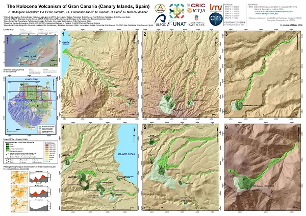
The work presents the first detailed map of the Holocene eruptions of Gran Canaria (Canary Islands, Spain) and was published in Journal of Maps. This map is a synthesis of collated and interpreted ï¬eld data and topographic maps. The researchers integrated information obtained from: detailed geological ï¬eld surveys, morphometric analysis of eruptive deposits, high-resolution digital elevation models, and aerial photographs. The principal research Alejandro Rofríguez-González explain that work has 4-dimemsions, the spacial dimension (3d) and the time dimension.
The work developed a methodology for generating palaeogeomorphological reconstructions of Digital Terrain Models to allow a proper understanding of the topographic changes that have taken place in the areas affected by Holocene volcanic eruptions in both the construction stages and their subsequent degradation.
The other researchers taken part in the work were: Francisco José Pérez-Torrado and Claudio Moreno-Medina(University of Las Palmas de Gran Canaria, Spain), José Luis Fernández-Turiel (Instituto de Ciencias de la Tierra Jaume Almera del CSIC, Spain), Meritxell Aulinas (University of Barcelona, Spain) and Raphaël Paris (University of Clermont Auvergne, France).
For more information:
Link to Journal of Maps